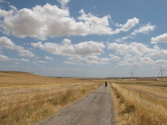
Leg 24 - From Castelluccio dei Sauri to Ordona
Leg 24 - From Castelluccio dei Sauri to Ordona
Gps Track
- Start: Castelluccio dei Sauri
- Arrival: Ordona
- Total Length: 19,9 km
- Difficulty by Foot: Easy
Via Francigena – Via Traiana.
- Leg 38 – From Torre Santa Sabina to Brindisi
- Leg 33 – From Bari to Mola di Bari
- Leg 38 – From Serranova to Brindisi
- Leg 10 – From Itri to Formia
- Leg 09 – From Fondi to Itri
- Leg 01 – Variant of Caffarella – From Roma to Castel Gandolfo – 26,5 km
- Leg 12 – From Minturno to Sessa Aurunca
- Leg 07bis – Variant Sonnino – From Fossanova to Monte San Biagio
- Leg 21 – Winter variant from Buonalbergo a Celle San Vito
- Leg 18 – Variant on cycling lane – from Telese Terme to Benevento
- Leg 16 – Variant II from Solopaca to Vitulano
- Leg 18 – From Telese Terme to Vitulano
- Leg 21 – From Buonalbergo to Celle San Vito
- Leg 44 – From Vignacastrisi to Tricase
- Leg 31 bis – From Ruvo di Puglia to Bitonto (through Terlizzi, Sovereto)
- Leg 45 – From Tricase to Leuca
- Leg 43 – From Otranto to Vignacastrisi
- Leg 42 – From Martano to Otranto
- Leg 41 – From Lecce to Martano
- Leg 40 – From Torchiarolo to Lecce
- Leg 39 – From Brindisi to Torchiarolo
- Leg 37 – Variant – From Torre Canne to Torre Santa Sabina
- Leg 37 – From Torre Canne to Torre Santa Sabina
- Leg 36 – From Savelletri to Torre Canne
- Leg 35 – From Monopoli to Savelletri
- Leg 34 – From Mola di Bari to Monopoli
- Leg 32 – From Bitonto to Bari
- Leg 31 – From Ruvo di Puglia to Bitonto
- Leg 30 – From Corato to Ruvo di Puglia
- Leg 29 – From Andria to Corato
- Leg 28 – From Canosa to Andria
- Leg 27 – From Cerignola to Canosa
- Leg 26 – From Stornara to Cerignola
- Leg 25 – From Ordona to Stornara
- Leg 23 – From Troia to Castelluccio dei Sauri
- Leg 22 – From Celle San Vito to Troia
- Leg 20 – From Benevento to Buonalbergo
- Leg 19 – From Vitulano to Benevento
- Leg 17 – From Faicchio to Telese Terme
- Leg 16 – From Alife to Faicchio
- Leg 15 – From Statigliano to Alife
- Leg 14 – From Teano to Statigliano
- Leg 13 – From Sessa Aurunca to Teano
- Leg 11 – From Formia to Minturno
- Leg 08 – From Terracina to Fondi
- Leg 06 – From Sezze to Priverno-Abbazia di Fossanova
- Leg 04 – From Cori to Sermoneta
- Leg 03 – From Velletri to Cori
- Leg 02 – Variant of Gallerie di sopra
- Leg 02 – From Castel Gandolfo to Velletri
- Leg 01 – From Roma to Castel Gandolfo
- Leg 07 – From Abbazia di Fossanova to Terracina
- Leg 05 – From Sermoneta to Sezze
- Leg 15 – Variant Roccaromana – Alife


