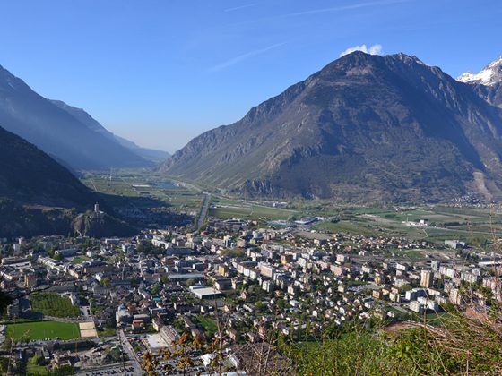
BS3 From Villeneuve to Martigny
BS3 From Villeneuve to Martigny
Gps Track
- Start: Villeneuve
- Arrival: Martigny
- Total Length: 44,5 km
- Cycle type: Street
- Difficulty by Cycle: Easy
We leave the banks of Lake Leman to follow the Rhone River in the opposite direction until Martigny, the last stage before crossing the Alps!
From Villeneuve, the route crosses the Grangettes nature reserve to pass over the Rhône and join the left bank. You are now in the canton of Valais. You follow the Rhône as far as the town of Saint-Maurice where the defile forces you to leave the river bank. A stop at the treasure of the Abbey, which has been occupied non-stop for more than 1500 years, is well worth!
In the next village of Evionnaz, you will find the left bank of the Rhône until you reach Martigny. This ancient town, nestled between hills and forests, is the point of intersection of important roads: as far as Lake Leman, the Simplon pass, towards Savoy and the Aosta Valley. It is also the home of the rescue dog “Barry”. This breed of St. Bernard is native to the Great St. Bernard region, your next stop!
You will find food and drink in all the villages and there are frequent fountains.


