
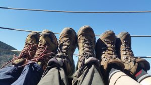
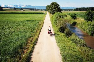
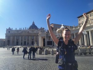
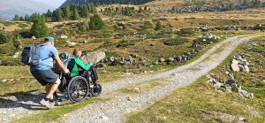
In 2021 I had the pleasure, and the honour, of walking the entire 3.200 km of the Via Francigena for the Road to Rome anniversary event. From the UK into France, and on to Switzerland and Italy: it has been a truly enriching and challenging experience for me during which I’ve gained a more profound knowledge and understanding of the Via Francigena. Many people afterwards have asked me about the sections I liked the most, the ones that have left a special mark. This is a very difficult question to answer, because every region, every town has its own story to tell. In this article I would like to dive deeper into the relatively unknown part of the Via Francigena that crosses the Italian region of Campania.
The Via Francigena enters the Campania territory after crossing the Garigliano river, leaving the Latium region behind. While walking along the Via Francigena in Southern Italy, Campania will be your penultimate region to cross before reaching Apulia and with it Santa Maria di Leuca, Via Francigena’s finibus terrae. For a long time, the development of the Via Francigena itinerary in Campania has lagged behind in comparison to Latium and Apulia, but now thanks to regional funding signposting has been placed along all 10 stages. Furthermore, the recently published guidebook by Terre di Mezzo is another essential tool for pilgrims to travel along the Via Francigena in Southern Italy.
Below is my attempt at listing, for each of the 10 stages, one or more highlights that cannot be missed when walking along the Via Francigena in Campania. With a big thank you to Annalisa Galloni from Anime Erranti for her help with putting together this list.
1. Sessa Aurunca: Ancient Roman Theater and the Cathedral of Saints Peter and Paul
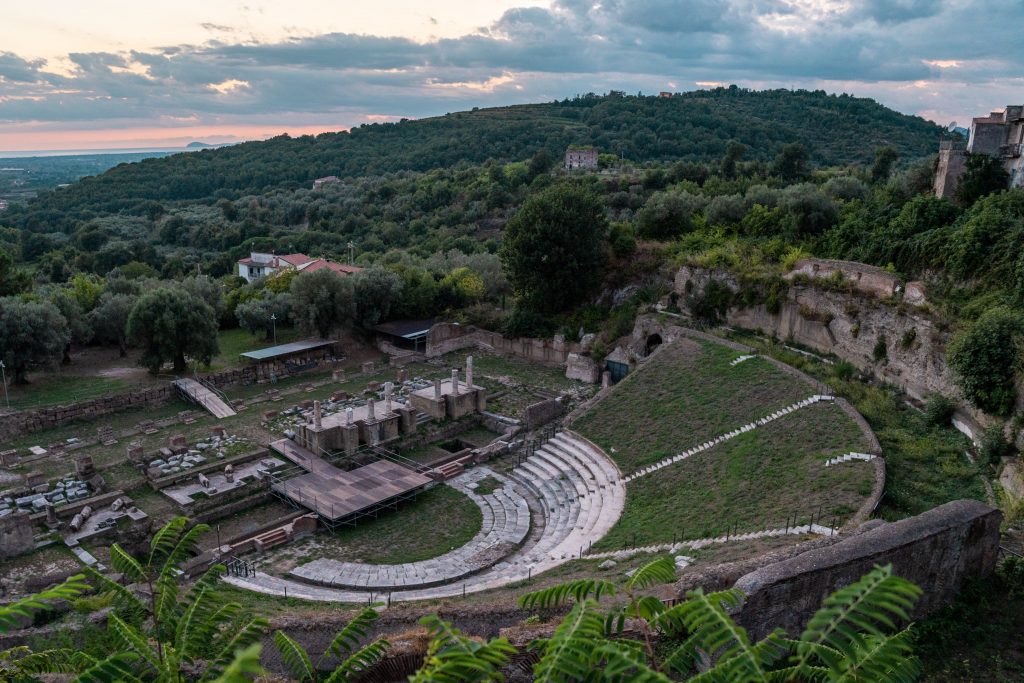
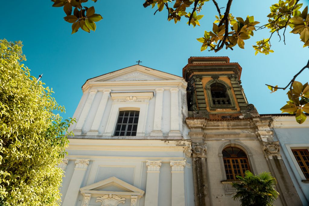
The first stage of the Via Francigena in Campania ends in Sessa Aurunca. This town, like many others in Italy, has ancient origins with historical records dating back to Roman times. It was an important center during the Roman Empire and throughout its history has been influenced by various other cultures as well, including the Lombards, Normans, and Swabians.
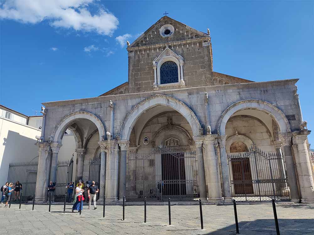
One of the main cultural attractions in Sessa Aurunca is without a doubt its well-preserved Roman theatre from the 2nd-1st century BC. Carved into the volcanic tuff hill the town is built upon, the theatre was excavated only very recently in 2001. From the theatre, spectators must have had a spectacular view of the Gaeta Bay. Also not to miss during your stay in Sessa Aurunca is the impressive Cathedral dedicated to Saints Peter and Paul. The construction of this medieval basilica was begun in the year 1103, and inside the entire floor is covered with beautiful mosaics in Cosmatesque style.
And if you’re a fan of medieval castles and architecture just like myself, you should definitely go and check out the Ducal Castle located at the heart of the town. Built around the beginning of the 10th century on the old acropolis, it was later reconstructed not only for military fortification purposes (castrum) but also as a residence for the lord of the city. A strong earthquake in 1688 severely damaged the castle, but luckily for us it was repaired and in the year 1806 the castle became the property of the municipality, which initially used it as a prison and later as a school. Following restoration work from 2007 to 2014, it now houses the Civic Museum and the Municipal Library “Caio Lucilio.”
➡️ Click here to view the map and download the GPX track for this stage
🛏️ Where to sleep in Sessa Aurunca: B&B Monte Ofelio
2. From Sessa Aurunca to Teano: Via Adriana original Roman road
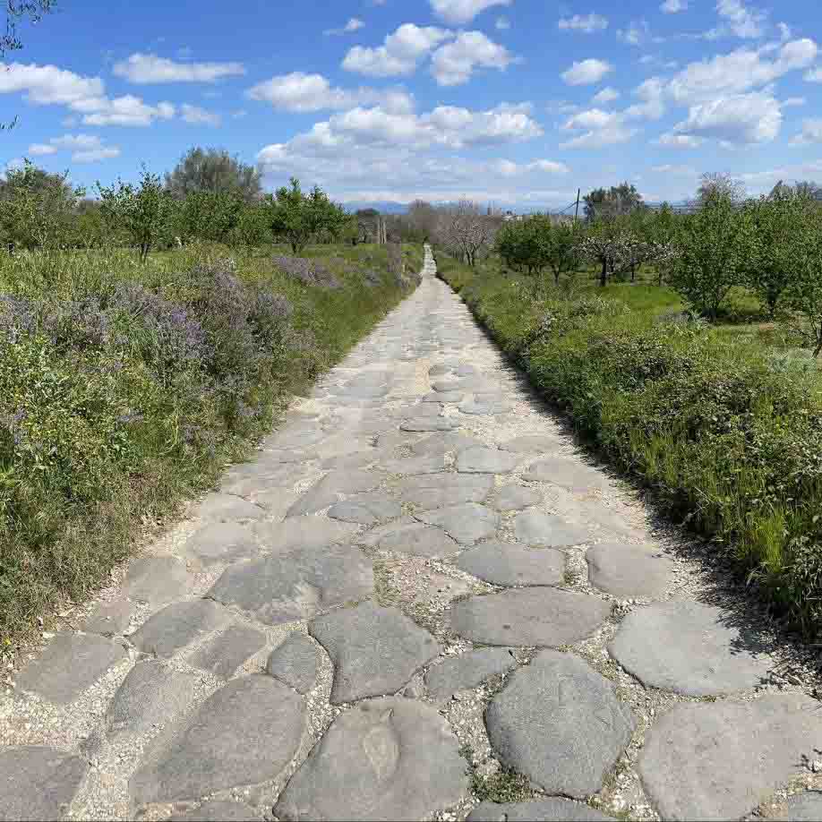
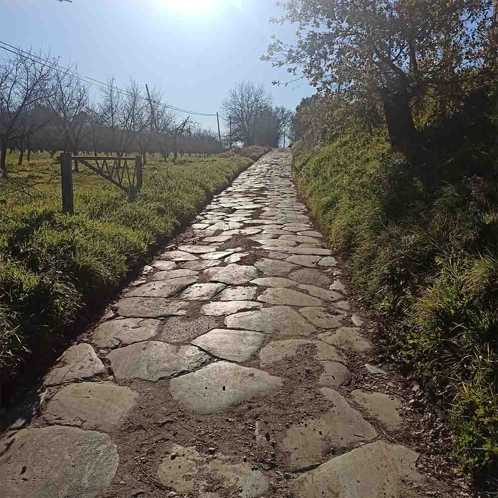
When least expected, shortly upon arrival in the town of Teano you will literally step foot on history along this stretch of the Via Francigena. For approximately 1,5 kilometres the itinerary follows the ancient Via Adriana, with stretches of the road still paved with the ancient basolato, the traditional big paving stones used by the Romans to create their famous roads. It’s not difficult to imagine being a Roman soldier in ancient times, or a pilgrim in the Middle Ages, walking these on incredibly well-preserved stones leading to or from the Eternal City.
Just like many other towns and cities along the Via Francigena in Campania, also in Teano you will find an ancient Roman Theatre on the outskirts of the town, as well as an archaeological museum where historical treasures from the surrounding area are being preserved.
➡️ Click here to view the map and download the GPX track for this stage
🛏️ Where to sleep in Teano: Monastero Santa Caterina
3. From Teano to Statigliano: the picturesque towns of Pietramelara, Riardo, and Roccaromana
Along stage 3 of the Via Francigena in Campania you will cross 3 beautifully preserved medieval towns: Riardo, Pietramelara, and Roccaromana.
Riardo
The town of Riardo, renowned since Roman times for its mineral waters, maintains the characteristics of a medieval village, with its focal point being the Lombard-founded castle from the 9th century that overlooks the Savone plain. Although the structure underwent expansion during the Norman era, it was the Angevins who influenced its present-day appearance, characterized by circular towers and battlement walls. The town’s historic center is meticulously preserved, with several buildings restored and repurposed into artisanal shops and exhibition venues.
Pietramelara
The quaint village of Pietramelara, nowadays unfortunately partially deserted, stands out as one of the most distinctive ones in the region. Established by the Lombard princes Landolfo and Adenolfo in the 8th century, it took shape in a concentric layout centered around the sole surviving medieval tower. Its history is equally captivating: Pietramelara has resurrected from ruin twice, first in 1496 following a brutal assault by the Aragonese, where only seven families endured and are credited with rebuilding the village, and again in 1944 after the harrowing withdrawal of the German army. Beyond the village, a visit to the Church of the Most Holy Annunciation is highly recommended. Founded in 1597, it houses paintings from the Venetian school and was originally linked to the grand Ducal Palace via a garden, now repurposed as a cultural venue. Also noteworthy are the stuccoes adorning the sixteenth-century Church of San Rocco and the artworks displayed in the Church of the Augustinians, whose former convent now hosts the Museum of Sacred Art.
Roccaromana
The hamlet of Roccaromana emerged following the destruction of the ancient Saticula, located near present-day Statigliano, which was a point of contention between the Samnites and Romans, as chronicled by Livy and Virgil in their works. It wasn’t until the 8th century AD that the town became a part of the Lombard duchy of Benevento, and during this period, the first fortification was erected atop Mount Castello to monitor the Volturno area and a branch of the Via Latina. The Lombard structure was later encompassed entirely within the Norman Tower, built around 1100, reconstructed in 1948 after the bombings of the Second World War, and recently restored. A similar fate befell the adjacent church dedicated to the Madonna del Castello, dating back to 1190: the chapel preserves its original flooring and two frescoes from the 15th and 16th centuries. In the small village at the mountain’s base, one can also find the Church of San Cataldo Vescovo, the current mother church, from the modern era, and the Purgatorio chapel (1409), adorned with a fresco depicting the Madonna enthroned.
Not to be missed, for enthusiasts of fine dining, is the “cacio forte”: a local cheese with long aging, renowned for its robust flavour.
➡️ Click here to view the map and download the GPX track for this stage
🛏️ Where to sleep in Pietramelara: I Giardini di Palazzo Ducale
🛏️ Where to sleep in Roccaromana: Il Giardino Segreto di Roccaromana
4. From Statigliano to Alife: the ancient city of Aliphae
While planning your walking or cycling stage to the town of Alife, out of curiosity I invite you to take a look at the town from above with Google Maps. On the map you will clearly see the perfect rectangular form of the town, with its ancient decumano and cardo streets still perfectly in place.
The modern town of Alife stands where once upon a time the ancient town of Allifae was situated. An ancient Samnite town, founded around the 4th century BCE, Allifae played a strategic role in the Samnite Wars and later became a Roman municipium, thriving as a center for agriculture and trade. Upon arrival at the town, you’ll notice that ancient Allifae’s remains, including city walls, streets, and public buildings, still attest to its significance in both the Samnite and Roman periods. Known for its agricultural production and strategic location between the Apennine Mountains and the Campanian plains, Allifae flourished under Roman rule but declined during the late Roman Empire. While it was largely abandoned by the early Middle Ages, its ruins provide valuable insights into ancient Samnite and Roman civilization.
In and around Alife some of the remnants of the Roman period that you’ll find are the ancient amphitheatre, the Mausoleum of the Acilii Glabriones family with some beautiful mosaics inside, as well as several entrance gates to the city. Before leaving Alife, make sure to take a moment to realize that you’re literally walking on history and that you’re surrounded by these incredible stories from the past.
➡️ Click here to view the map and download the GPX track for this stage
5. From Alife to Faicchio: the ancient Roman bridge of Fabio Massimo
This stage’s highlight can actually be found right after leaving the town of Faicchio, when you’ll already be on your way to Telese Terme. After following the main road for a little while, you’ll turn left onto a gravel path that will lead to the Titerno river. You’ll cross this river using the ancient Fabio Massimo bridge. This bridge was originally constructed during the Republican period atop a previous Samnite structure. It featured two basic stone and concrete elements with wooden planks for pedestrian and animal passage. Legend suggests that Quintus Fabius Maximus crossed it to confront Hannibal, hence the name.
Unfortunately, over time, the bridge underwent numerous modifications after events like the 1688 earthquake and the 1860 flood, which led to the addition of the left vault for structural support. In 2008, controversial restoration work by architect Vincenzo Vallone gave the bridge its current, more modern look, using techniques previously foreign to the structure like plastering the upper part and vault interior. The parts left from the original bridge include the main arch over the river and a left arch, both with brickwork resting on Samnite remnants, identified by typical polygonal stonework akin to that of nearby Arce on Monte Acero.
➡️ Click here to view the map and download the GPX track for this stage
6. From Faicchio to Telese Terme: sulphurous waters and Lake Telese
After you’ve crossed the Fabio Massimo bridge but before you’ll be able to put your tired feet into the relaxing and regenerating waters of Telese Terme, you will come across a very particular, natural phenomenon along this stage in Campania. I am talking about the doline of Monte Pugliano. In local dialect these chasms are called Puri, which according to some scientists comes from the Greek word for fire. For a long time it was therefore understood that these chasms are actually volcanic craters. However, the complete absence of volcanic material in the area confirms that these phenomena are instead generated by the collapse of ancient caves dug by water.
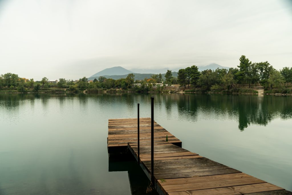
At the end of stage 6 along the Via Francigena in Campania, you will arrive in the city of Telese Terme. The name of the city immediately reveals what it’s renowned for: sulphurous waters and their therapeutic properties. These mineral-rich waters have attracted visitors for centuries, seeking relief from various ailments and indulging in wellness treatments. The thermal baths in Telese Terme offer a serene retreat, where visitors can immerse themselves in rejuvenating pools or partake in therapeutic massages and mud baths. A perfect break from the journey along the Via Francigena, and a real treat for your feet! And not only for your feet: at the thermal baths you’ll find a fountain where you can take a sip of the sulphurous water. We were offered a glass during the Road to Rome 2021 event, and what to say… I would be lying if I’d say I liked it, but it was definitely an interesting and new experience.
Just outside of the town you’ll find Lake Telese, nestled amidst picturesque surroundings, adding to the charm of the area. Fed by natural springs, the lake boasts crystalline waters with a subtle hint of sulphur, believed to have healing benefits. Visitors can enjoy leisurely walks along the lakeshore, admiring the tranquil scenery or embarking on boat rides to explore its serene waters. Whether seeking relaxation or wellness, the sulphurous waters of Telese Terme and the serene beauty of Lake Telese offer a rejuvenating escape in the heart of Campania, Italy.
➡️ Click here to view the map and download the GPX track for this stage
7. From Telese Terme to Vitulano: glorious wine and famous marble
The stage from Telese Terme to Vitulano may seem relatively short with only 16,1 kilometres, but let there be no mistake: there will be lots of climbing into the Taburno-Camposauro regional park up to an altitude of approximately 800 above sea level.
After the first 5 kilometres you will arrive in the town of Solopaca. In the nineteenth century, Solopaca was called “little Naples” because of the fame of its wine and oil; even today, the city is renowned for the production of DOC wines, both red and white, and for the Grape Festival that takes place in September. So before continuing your way up into the Appennines, make sure to have a taste of these local delicacies.
After a quick stop in Solopaca it’s time to prepare your legs, because from here the real climb up into the regional park starts. The protected natural reserve that you’ll be crossing teems with a diverse flora and fauna, offering hikers scenic trails and captivating vistas.
And make sure to prepare your palate at the end of this stage, because another tasty grape thrives in this area, namely the noble Aglianico grape. A glass of this esteemed Aglianico del Taburno DOCG wine, celebrated for its complexity, depth, and elegance, is therefore an absolute must.
Upon arrival in Vitulano you may notice a prominent place for marble sculptures in this little town. In fact, the famous Vitulano marble, a prized red limestone known for its striking color and durability, has been prominently used in several significant architectural projects, including the Reggia di Caserta in Italy and the Kremlin in Moscow. In the Reggia di Caserta, one of the largest royal palaces in the world, this marble was employed to enhance the opulence of its grand interiors, contributing to the palace’s reputation as a masterpiece of Baroque architecture. Similarly, in the Kremlin, Vitulano marble was utilized to augment the grandeur of its historic structures, reflecting the Tsarist regime’s affinity for luxurious and resilient materials.
➡️ Click here to view the map and download the GPX track for this stage
🛏️ Where to sleep in Solopaca: Palazzo Cusani
🛏️ Where to sleep in Vitulano: Mountain View Room | B&B Camposauro | B&B Borgo San Pietro | Casa Vacanza Relax e Svago
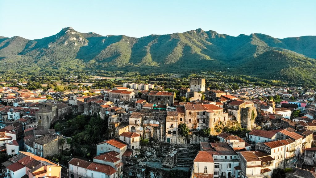
8. From Vitulano to Benevento: from Trajan’s Arch to traditional sweets
When we arrived in Benevento during the Road to Rome event, it wasn’t my first time in this beautiful city. I had been here also the year before, only in passing, when I was travelling the Via Francigena in Italy by bicycle.
Benevento is one of those cities that you may not even have heard of if you’re not familiar with the Campania region, but I’m sure it will leave you mesmerized by its beauty and history. Being still relatively undiscovered by main tourism, Benevento has managed to maintain its authenticity making it the perfect place for a break from walking.
In ancient times the city’s name used to be Maleventum, which then turned to Beneventum later on. The original inhabitants of this area, the Samnites, were defeated by the Romans and many beautifully preserved monuments from the Roman era can still be admired throughout the city. The most impressive and well-known one is without a doubt Trajan’s Arch, erected between 114 and 117 CE on the occasion of the opening of the Via Traiana, a road variant of the Via Appia that would shorten the travel time from Rome to Brindisi. Can you imagine arriving in Benevento on foot hundreds or even more than a thousand years ago and being welcomed by this imposing structure? It must have been an amazing experience for pilgrims in those days. Although a bit smaller in size, Trajan’s Arch can easily be considered equal in beauty to the much more famous Constantine’s Arch in Rome.
Other Roman monuments that can be admired in Benevento include the Roman Theatre, the Sacramento Arch, and the Leproso Bridge.
And when in Benevento, make sure not to miss out on the local delicacy: nougat. The Torrone di Benevento is a traditional sweet crafted from a mixture of honey, sugar, and nuts. Deeply rooted in Benevento’s culinary culture, the torrone reflects the region’s agricultural abundance and artisanal expertise.
➡️ Click here to view the map and download the GPX track for this stage
🛏️ Where to sleep in Benevento: Parrocchia del Beato Giuseppe Moscati | B&B Al Duomo
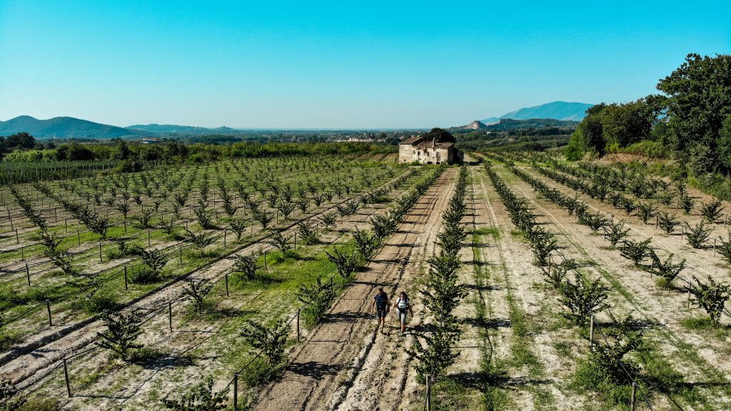
9. From Benevento to Buonalbergo: rolling hills and Extra Virgin Olive oil DOP from the Ufita hills
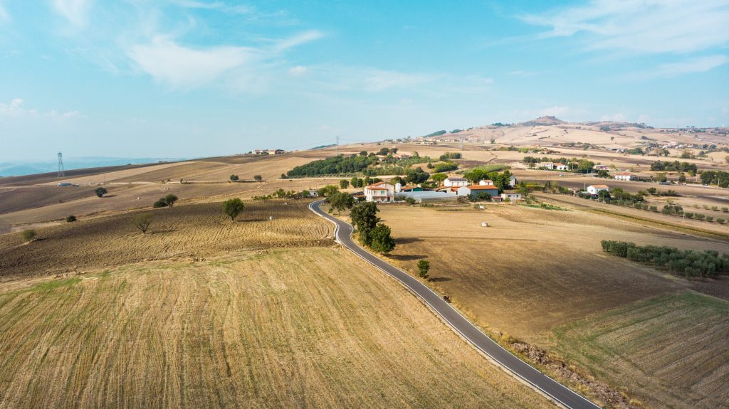
Depending on the season you’ll be walking this section, you’ll be able to admire gorgeous green sceneries with rolling hills that sometimes remind of the popular Via Francigena stretch in Tuscany. In fact, in my opinion this part of the Via Francigena can absolutely be considered equal in natural beauty compared to some of the other more popular stretches of the route.
When you are walking in this area, make sure to make some space in your backpack for a small bottle of Extra Virgin Olive Oil coming from the nearby Ufita hills. This Irpinia Colline dell’Ufita DOP oil (DOP in Italian stands for Protected Designation of Origin) is a hallmark of the region, celebrated for its distinct taste and purity. Produced through time-honored methods and nurtured by the Mediterranean climate, this olive oil encapsulates the essence of the local agricultural tradition and culinary prowess. A great little souvenir to carry with you for the remainder of your journey and to enrich the tastes of any salads or other foods you will be eating in the days and stages to come.
➡️ Click here to view the map and download the GPX track for this stage
🛏️ Where to sleep in Paduli: Casa vacanze Clementina
🛏️ Where to sleep in Pietrelcina: Pensione la Gardenia
🛏️ Where to sleep in Buonalbergo: Casa del Pellegrino | Casa del Pellegrino Madonna della Macchia | Rifugio del Pellegrino
10. From Buonalbergo to Celle di San Vito: volcanic activity in the fields of Faeto
I have to admit, I have never walked the Camino de Santiago. I know this is where many people start their long-distance hiking adventures, and as a logical consequence many of them eventually end up on the Via Francigena as well. For me it’s basically the other way around: my first long-distance walk was immediately the entire 3.200 km of the Via Francigena, without any previous experience. And who knows if I’ll ever make my way to Santiago de Compostela. I’m not a big fan of mass-tourism, so my (not so) wild guess would be “probably not”.
But why talk about the itinerary in Spain, you may ask, when we’re here to talk about the Via Francigena in Campania? Well, it all has to do with the landscapes you will encounter when approaching the Apulian border. I have it from several reliable sources, you know… those who have walked along the famous Spanish route, that the last part of the Via Francigena in Campania and the first part of the Via Francigena in Apulia carry a strong resemblance to the famous mesetas area in Spain. Of course I have to take their word for it because I’ve never been there, but after seeing images on the internet I have to say that I agree. And it shouldn’t come as a big surprise, because when looking at the map of Europe you can see that these two areas are located more or less at the same latitude.
When I was walking along this gorgeous stage towards Celle di San Vito, I was pleasantly surprised to see all of a sudden bubbles and other natural activity coming from the right side of the road: I had arrived at the well-known bolle di malvizza! The Malvizza mud volcanoes form the region’s largest array of mud volcanoes. Unlike volcanic phenomena such as mofettas, fumaroles, and solfataras, the Malvizza mud volcanoes are entirely sedimentary. They share similarities with the salse (saltwater springs) found in the central-northern Apennines and the maccalube (mud fountains) of Sicily.
With mud volcanoes and plenty of gorgeous vistas along the road, make sure to take out your camera when approaching this area, because many a great photo-op will present itself gifting you some precious keepsakes for when you’re back at home after finishing your adventure along the Via Francigena in Southern Italy.
➡️ Click here to view the map and download the GPX track for this stage


